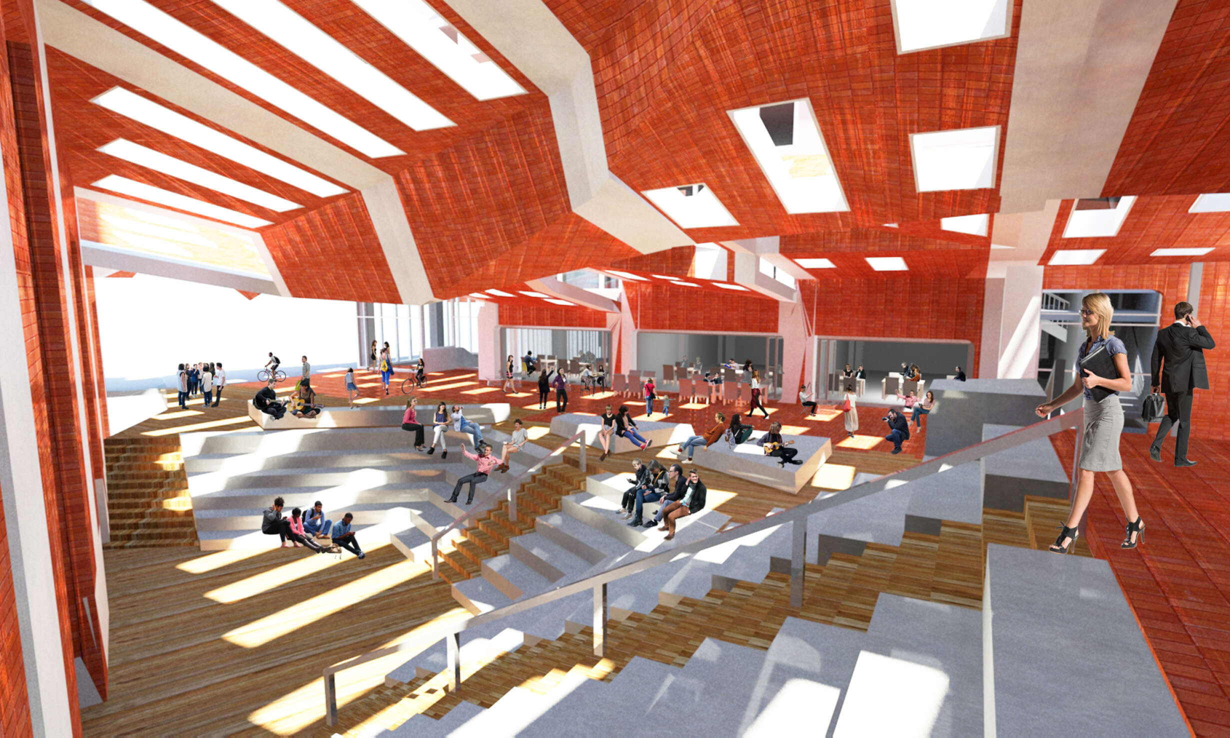
The city, when considered as a social phenomenon, is not a man-made product; it arises from an accumulation of societal events and processes, both planned and unplanned. This process-based view of urbanity places the built environment in the role of infrastructure: a facilitator of social process and events, that is both reactionary and catalytic. It allows its inhabitants to pursue their own ends by using the opportunities afforded by the city, and in doing so, generating new programmes and events. It is through this use of the city’s resources that the city itself is formed. This is particularly true of the public pedestrian realm, and its relationship to other facets of the built environment. This thesis investigates the tectonic and spatial formulation of this pedestrian social infrastructure.
Proponents of this process-based view of urbanism, a movement centering upon the writings of urbanist Jane Jacobs, focus on the relationships between elements of this infrastructural city, citing concepts of diversity, density and mix as facilitators of urban process that create ‘self-organising’ cities.
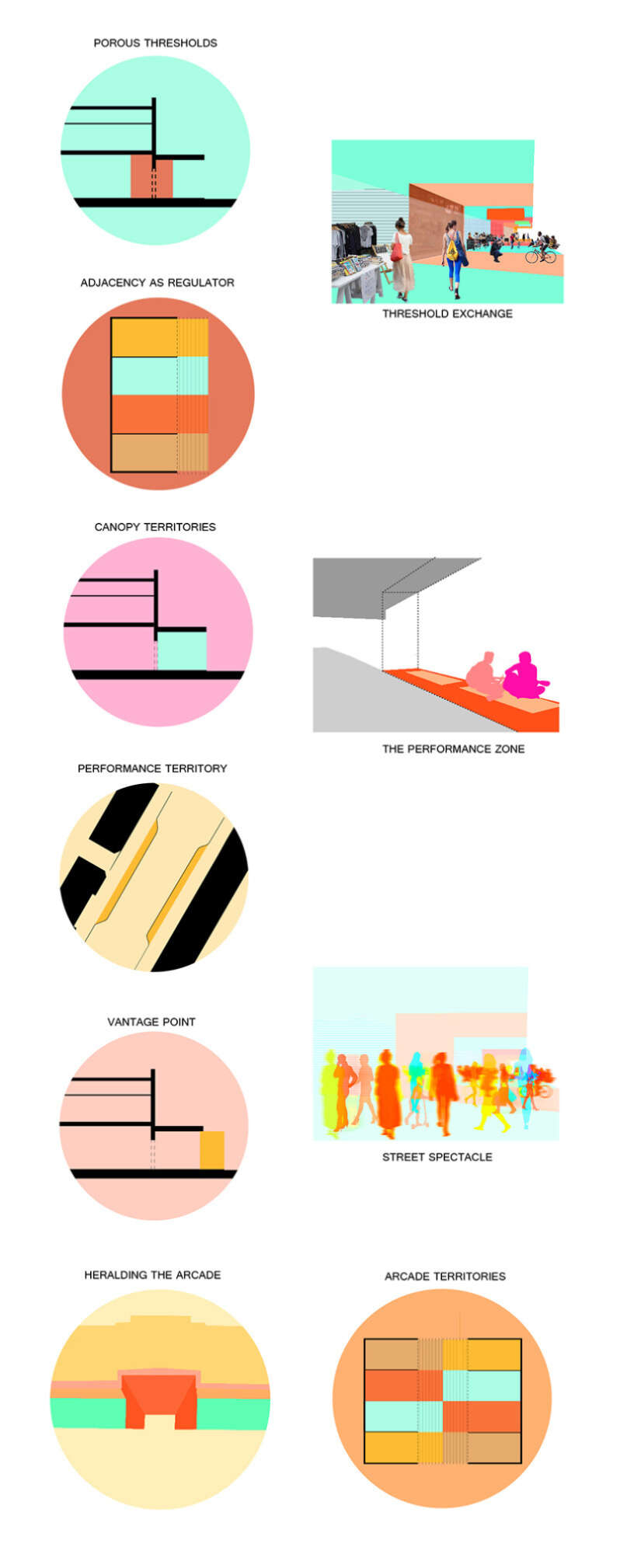
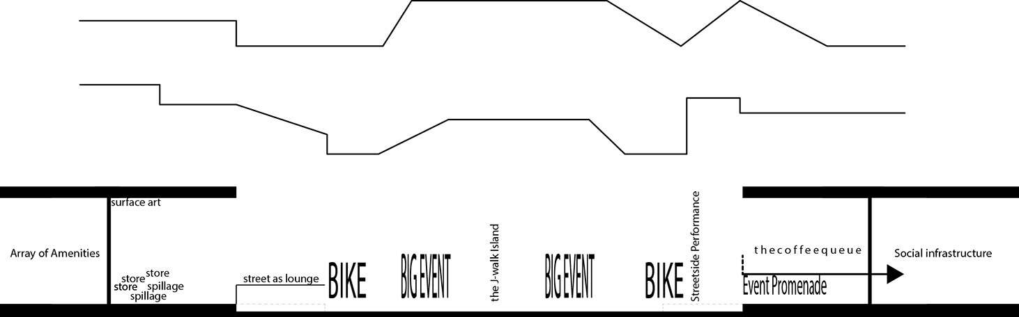
Landscape and infrastructural urbanist practices also view urbanity in an infrastructural sense. The manipulation of the programmed ground surface, a concept central to landscape urbanist practice, is used as a means of structuring dynamic relationships between temporal programmes, events and systems. This, too, facilitates the ‘process’ of urbanity in a self-organising and evolutionary manner.
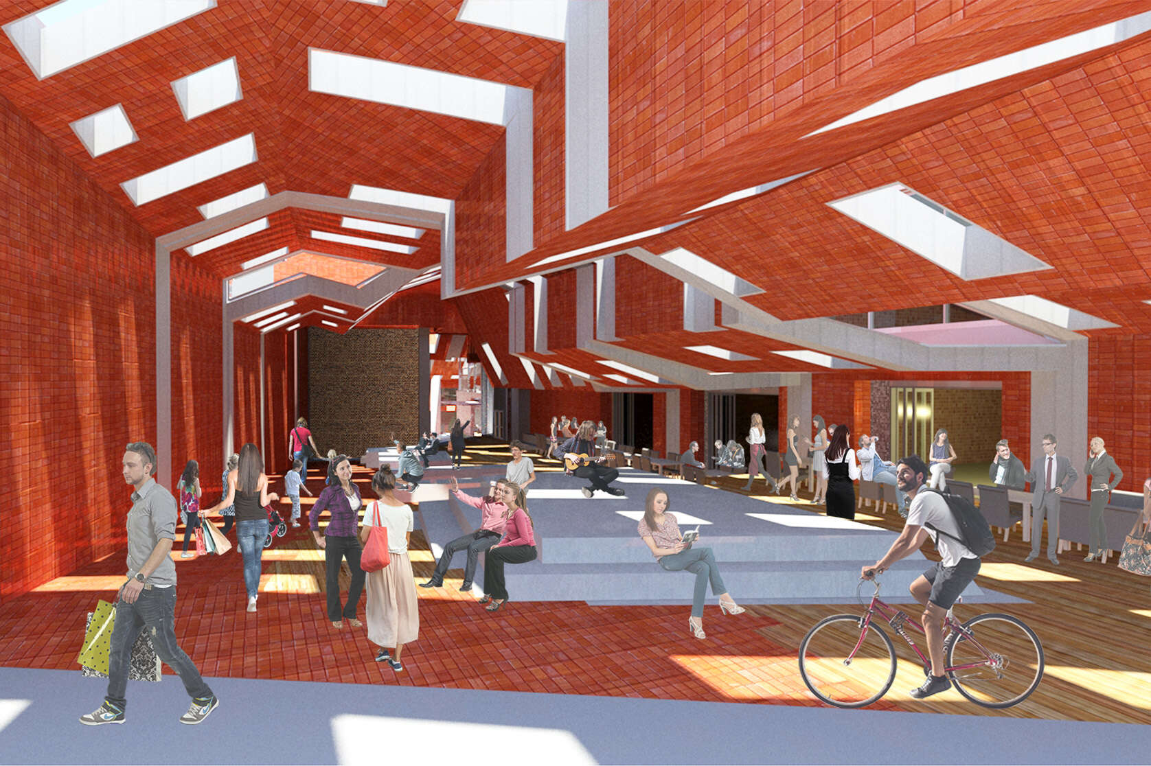
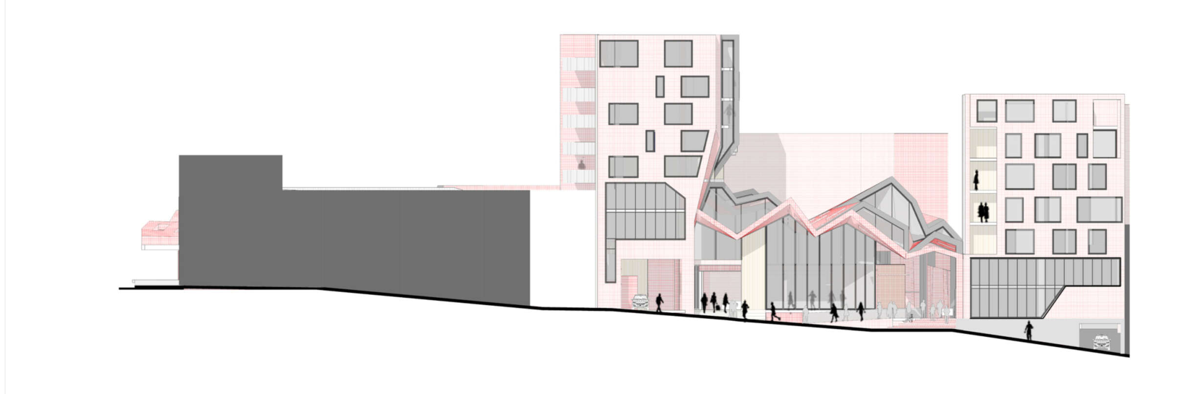
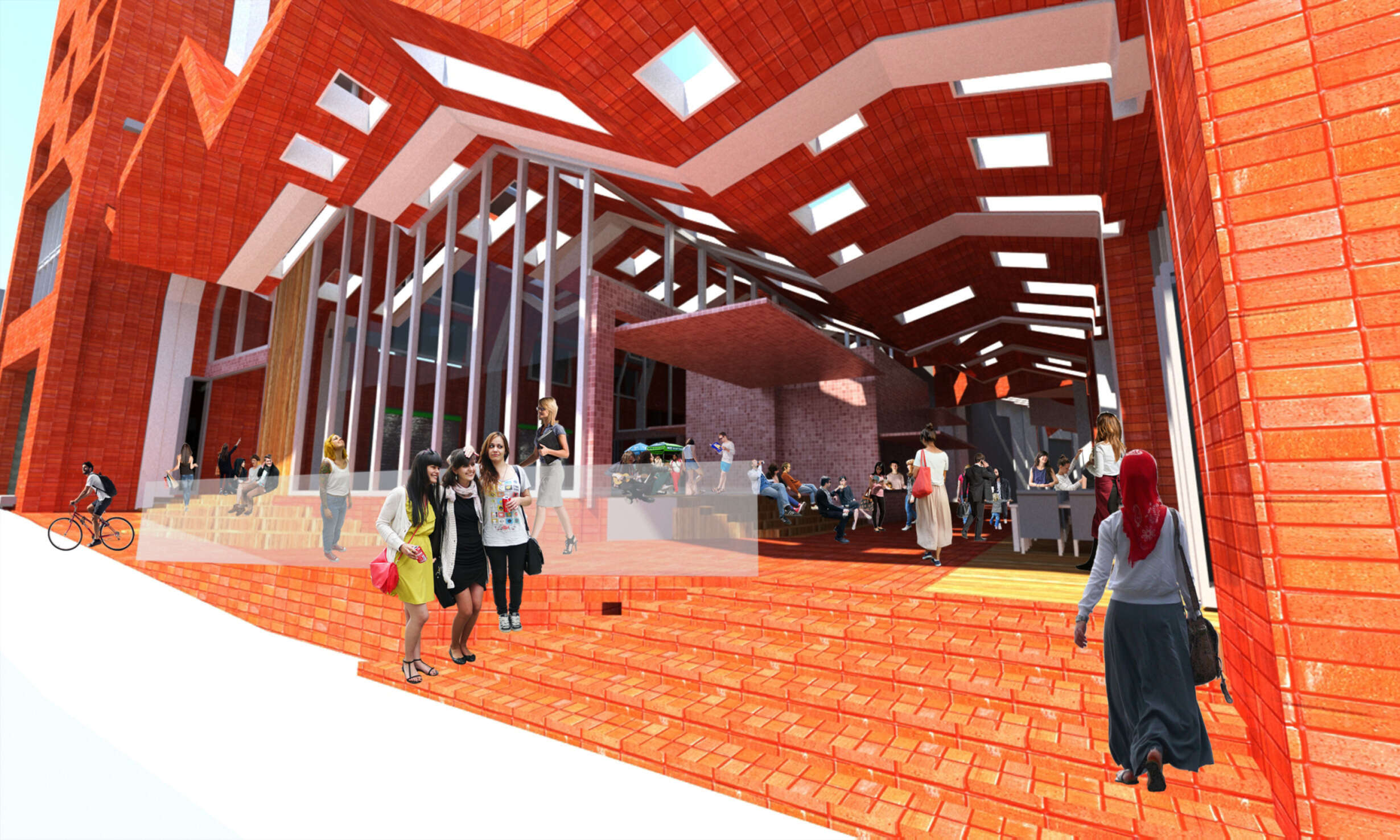
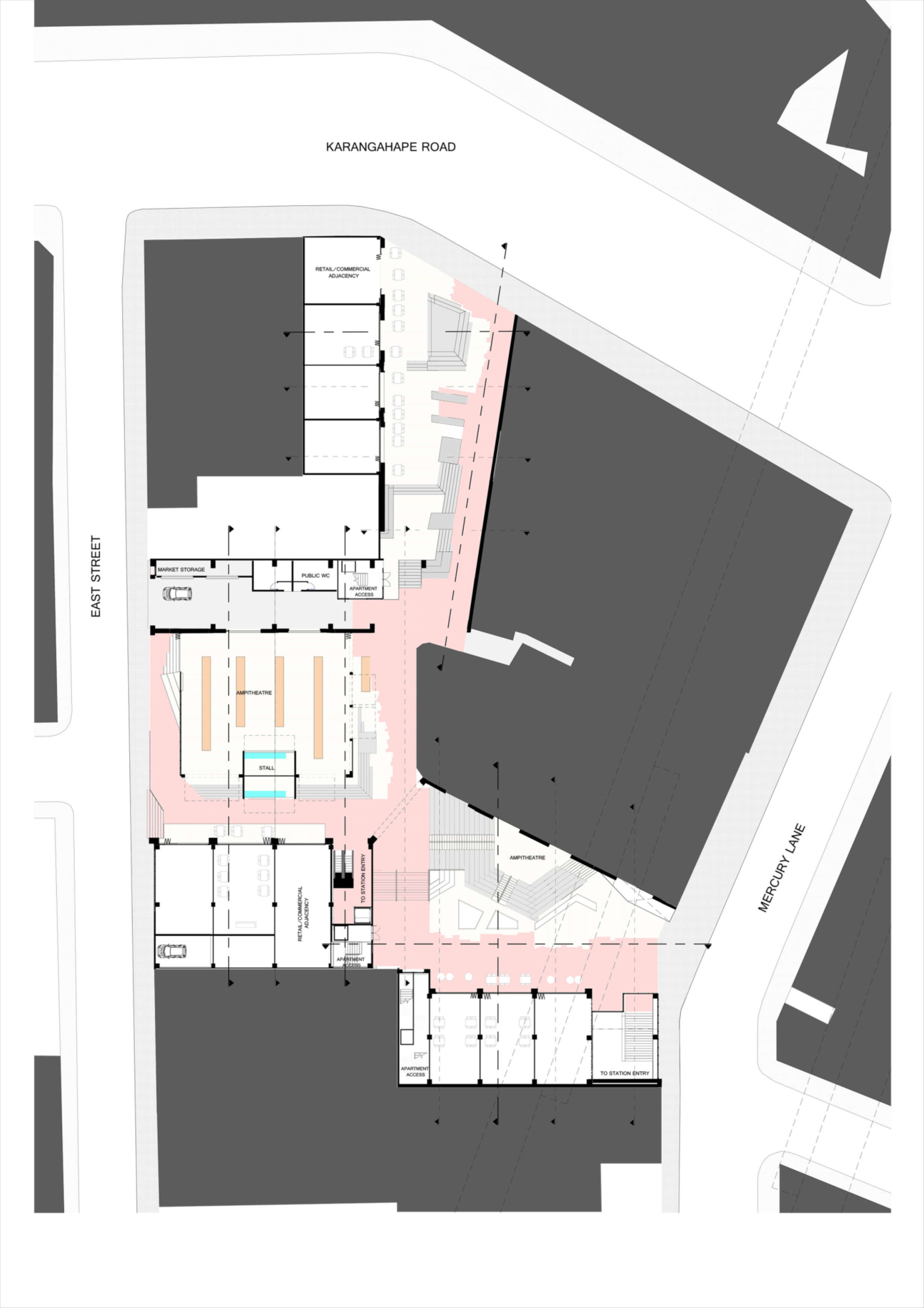
This thesis considers the methodology and theory of these two practices in relation to an architectural project for a City Rail Link station on Auckland’s Karangahape Road. Existing programmatic and spatial features of the street are considered in relation to these practices, allowing the formulation of a strategy to catalyse and facilitate urban processes and events of varying scales and temporalities. This strategy is deployed in the creation of a new vein of Karangahape Road that reinterprets, redistributes and intensifies the social infrastructure of its pedestrian realm.